Peak Hikers San Jacinto
|
May 15, 2016 |
As I was returning home from an all-day search for an overdue hiker in the San Jacinto Mountains (See Mission Write-up 2016-19), a text went out to team regarding another search. It turned out that this search would be approximately in the same area as the days earlier search. A few minutes after returning home from the first mission I received a follow-up call from Glenn Henderson to confirm whether I was available for this mission. I was, and after a quick 5-minute shower and some fresh clothes I was out the door on the road again, heading back to the Palm Springs Aerial Tramway where I departed from just an hour and a half earlier.
It turned out this search would be for 3 lost hikers. Luckily one of the hikers was able to get a brief cell signal to call 911 for help. We were also able to acquire their GPS coordinates of their location on the mountain, which placed them near Miller Peak at an elevation of 10,000ft. While in route, team member Ray Weden was able to text out a map screenshot of their location with associated coordinates. Having their coordinates is great news as we knew their location right from start, as long as they stayed there and not leave that location!
Once we arrived at the upper tram station, we quickly set up base and radio communications which would be managed my Michael George. Within a few minutes, Eric and I would quickly begin our hike up. We determined that the quickest way to get to them was not to take the designated trails, but to go off trail and take a straighter line approach to them. Within a short period of time, we reached our subjects.
We arrived to our subjects good spirits, and determined they needed no urgent medical attention. Just a little cold and hungry. We did provide some aid which included warm jackets, wrapped them with sleeping bags, provide some food, and hot chocolate/coffee. As they were getting warmed up, they provided us a little info on their intended hike and how they ended up off-trail. It turned out they were hiking the Cactus to Clouds Trail, and on their way down from the San Jacinto Peak they ended up walk off trail and continued into some thicker brush and unable to find back the trail they were previously on.
Once they were warmed up and ready to start the hike, we packed our gear and headed back down the mountain to the upper tram station. We all arrived at the upper tram station at 4:00am, and took a short nap until tram was operational at 6:00am. At that time, we all loaded into the tram and headed down to the lower station where our mission would now be complete.
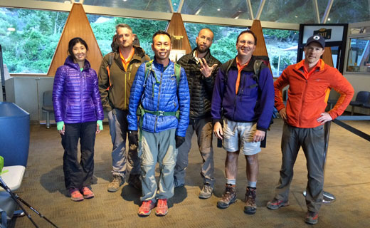
(l-R) Subject, Eric, 2 Subjects, Mike, and Cameron
Photo by Unknown.
Cactus to Clouds Trail
Cactus to Clouds Trail (aka Skyline Trail), which starts at the Palm Springs Art Museum and tops out at San Jacinto Peak. It has a total elevation gain of 10,300 with a length of 14 miles (one direction), making it one of the steepest hikes relative to distance in the US, and surprisingly in the world. When taking on the challenge of doing this hike, make sure you have the supplies necessary in case things go sour. Be prepared. Bring a GPS unit or map/compass on your hike which is generally good insurance to have in case one ends up off trail or in unfamiliar territory. These individuals did have a fair amount of supplies with them, but for those who are taking on challenge of an all-day hike like this one with the high elevation gains and temperature differentials, its also necessary to carry more food and water than you would expect to every use, a headlamp, and warmer layers in case you encounter unusual or unanticipated circumstances such as nausea/illness, sprained ankle other injuries, or getting lost!
RMRU Members Involved: Cameron Dickinson, Michael George, and Eric Holden.
Others Involved: Riverside County Sheriffs and Palm Springs Tramway.